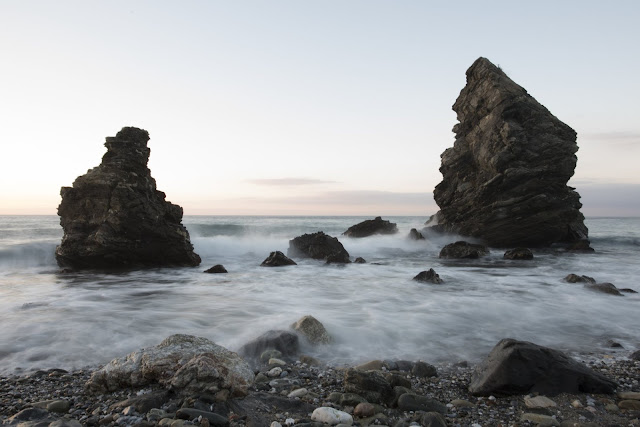
Located in the south of Spain, the Costa del Sol, or Sun Coast, is a region in the autonomous community of Andalusia. The area is made up of coastal communities and towns dotted along the coastline of the Province of Málaga. The region is a world-renowned destination for tourists with over 3 million visiting each year to take advantage of the glorious sunshine, sandy beaches, spectacular scenery, local cuisine and perhaps surprisingly some of the best golf courses anywhere in the world. As a holiday destination, it is easy to see why the region is such a popular tourist attraction. This easy to travel to destination really does have something for everyone, as TA-DAH.TV explain.
 |
| [ image: pexels by pixabay ] |
Not just beaches
The Costa del Sol
isn’t just a huge tourist attraction for those holiday makers looking for a
relaxing beach holiday or a vibrant nightlife with fantastic restaurants,
however. The local terrain is a spectacular and often overlooked attraction
that has seen a rise in popularity with hikers and other individuals who are
looking for something a little different and want to explore the scenery that
this beautiful area has to offer. The best way to travel around is by renting a car and drive according to your own timing.
The Caminito del Rey
The Caminito del Rey, which translates as The King’s Little path, is a walkway that is proving an increasingly popular draw since its new modern refurbishment. This narrow walkway is pinned against the steep walls of a narrow gorge located in the Ardales near El Chorro in Málaga. Originally called Camino del Rey, the walkway which is abbreviated locally to el Caminito has suffered over the years.
Having
fallen into disrepair, parts of the walkway were closed for over a decade in
order for extensive refurbishment work to be carried out. Following four years
of closure the walkway was reopened in 2015 and is anxious to shake off its
past when it was known as the most dangerous walkway in the world. Between 1999
and 2000 it was the unfortunate site of five deaths. The refurbishment now
means it is a safe place to walk what was one of the most important trade
routes in the region.
An important trade
route
Work began on the
construction of the walkway in 1901 and it was finished in 1905. It was built
to offer a way for workers from the two local hydroelectric power plants,
located at Gaitanejo Falls and Chorro Falls, to cross between the two
locations. It was also used to provide a way in which materials could easily be
transported and allow inspections and maintenance of the channel to be carried
out. The trade route that this offered was vital in saving time for those
people working in and around the area.
When the nearby Conde del Guadalhorce dam was inaugurated in 1921, King Alfondo crossed the walkway and it got the name by which it is now known. The walkway measures around 1 metre in width and is over 100 metres above the river below. Its original construction was concrete resting on steel rails which were supported by stanchions pushed into the face of the rock at a 45-degree angle.
It is the concrete construction that had eroded over the years making the walkway incredibly unsafe in places with complete sections of the concrete missing. The 2.9km of walkway was replaced by the local government at a cost of around €9 million, and whilst many of the original features remain in place the walkway now offers a wooden walking platform and fenced edges to offer visitors a significantly greater degree of safety.
There is also a museum near the walkway which offers a fantastic look at the history of the Malaga area.

No comments:
Post a Comment
Please Leave a Comment to show some Love ~ Thanks